|
[ Home ] [ Up ] [ Next ]
|
* * Hold cursor over pictures for text *
* Click
pictures to enlarge; close out of that window to return to this page * * |
|
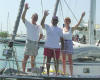
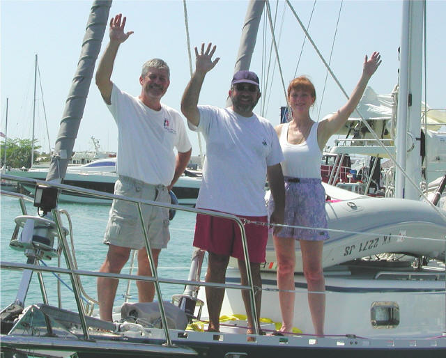
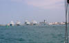
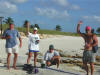
Steve, Jose and Debbie
in Key West, FL |
GULF OF MEXICO CROSSING - March 1 -
7, 2003: We, and friend Jose, an experienced sailor and racer,
left Clear Lake, TX at 8:00 Saturday morning, March 1, 2003, sailing the rhumb line straight across the Gulf to
Key West, FL - 800 miles away.
We were fortunate to have strong, favorable winds (20 - 30 knots) for most
of the trip, and with Jose tweaking the sails to the max, we arrived in Key
West 6 days 4 hours later - a day earlier than expected! For the first
3 days, it was cold/cool, overcast and seas rough, as we picked our way
through the many oil rigs and platforms offshore Texas and Louisiana, and
the various freighters, barges and fishing boats. Our radar was
indispensable at night, as our depth perception was about nil. Day 4
brought us warm temps, clear blue skies, and cobalt blue waters turning
turquoise green, which remained with us throughout the rest of the trip.
We had no mishaps nor major equipment failures on the crossing. We
spent 2 nights at Key West - treated ourselves to a marina as we cleaned up
boat, body and did laundry. Jose headed back to Houston and we left
Sunday (3/9) and are spending a few days in Marathon / Boot Key, Florida
Keys visiting a
friend and doing minor boat projects. We will leave for the Bahamas
when a good weather window opens. |
|
|
|
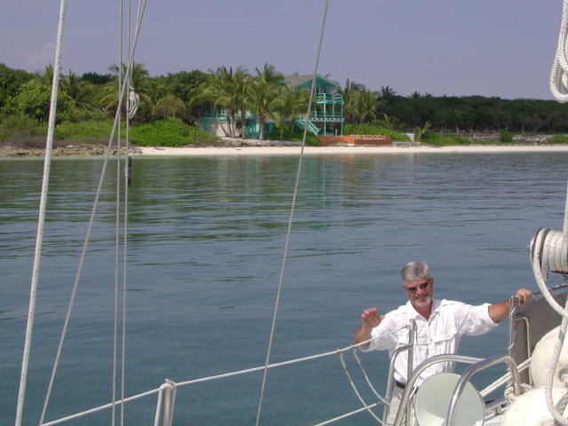
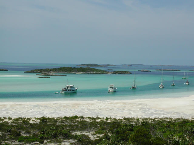
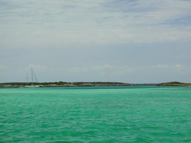
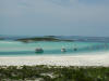
North Cat Cay, Bahamas:
Steve waiting on Debbie to get in the
dinghy; (picture doesn't do water justice)
Sunset at happy hour |
GULF STREAM CROSSING from MARATHON,
FL. to BAHAMAS - March 14
- 15: We left Marathon, FL early in the morning, and ventured into
the Gulf Stream, en route to the Bahamas, late afternoon. The Gulf
Stream can be very "challenging" to cross, as the current travels northeast
at several knots, and with northerly winds can create a chaotic sea state.
The first part of our trip was calm seas and gentle winds. We,
however, had to steer a course 30 to 50 degrees south of our destination, to
compensate for the pushing affects of the Gulf Stream. About 2:00 a.m.
thunderstorms developed that stayed with us until morning. Winds
picked up to 30 knots and seas became wild. ARGO handled it very well
and we stayed pretty dry in the cockpit. Amazingly enough, and with
effort, we were able to make our landfall destination on the mark. The
entry between Gun Cay and North Cat Cay, being very narrow and bordered by
submerged rock, was made further tricky with the tumultuous seas.
Sorry, no time to take pictures! Behind the islands lay calm, clear
turquoise waters. The water gets even better the further south we go.
North Cat Cay being a private island [for the rich Floridians] doesn't offer
much, other than a view from ARGO of a beautiful palm-tree saturated island
dotted with "quaint" houses here and there. Not bad. Oh yeah, we
have been reminded what a hassle it can be to check into Customs and
Immigration in the islands - a truly nonsensical experience where everybody
is on "island time". We are waiting on weather to leave for Nassau and
places south. |
|
|
|
|
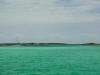
BERRY ISLANDS, BAHAMAS - March 18: Had a delightful beam reach sail from
N. Cat Cay
to Chub Cay, Berry Islands, 70 miles east across the Great Bahama Bank, with 15 knot winds
and emerald waters. Moved over to Frazer's Hog Cay.
Thoroughly enjoyed dinner at the Berry Island Club (small but popular little
house/bar where we met other cruisers).
|
|
|
|
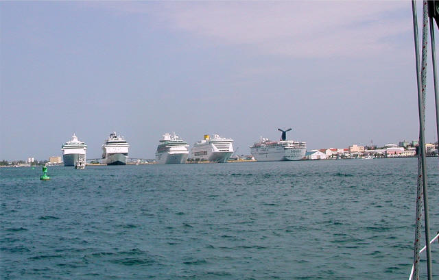
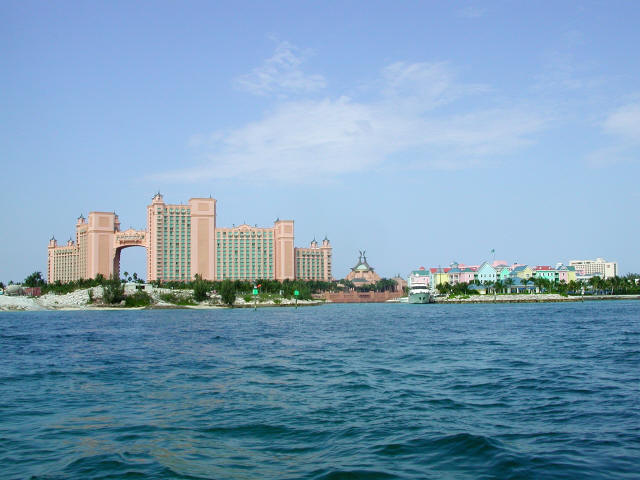
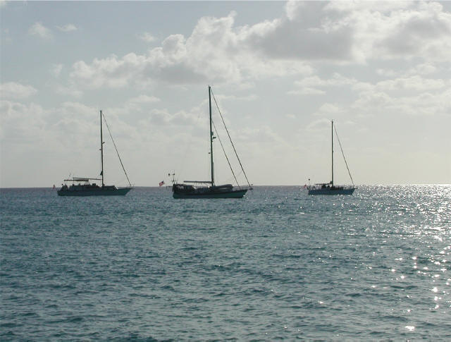
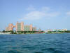
Nassau / Paradise Island, Bahamas
Coming in to port: Cruise ships;
Atlantis Resort
 |
NASSAU and PARADISE ISLAND, BAHAMAS -
March 22: We timed our departure day so winds would be favorable,
and as a result once again had a wonderful sail down island to Nassau.
This port is busier than we like, but we are waiting for a boat part (our
control unit on the windlass - the powerhouse on the bow that raises and
lowers the anchors - is malfunctioning). Keep running into the
same cruisers, so starting some good friendships that will probably continue
down island. Some of them will stay in the Bahamas; and others will
continue down to the eastern Caribbean as will we. We will wait for
good weather (i.e., favorable winds) and then take off to the Exumas.
The Exumas are a key destination for us and we plan to spend a lot of time
there leisurely. According to many cruisers, this is their
favorite cruising ground of any place.
|
|
|
|
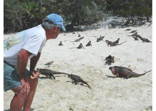
EXUMAS, BAHAMAS - March 26 - April 3:
So far in the Exumas we have been at 8 different
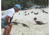 islands and
anchorages making our way down south to George Town where we are
now. These include: Allan's Cay is home to an islands and
anchorages making our way down south to George Town where we are
now. These include: Allan's Cay is home to an
 intriguing, albeit
ugly, prehistoric iguana (right). We then spent a week at Exuma
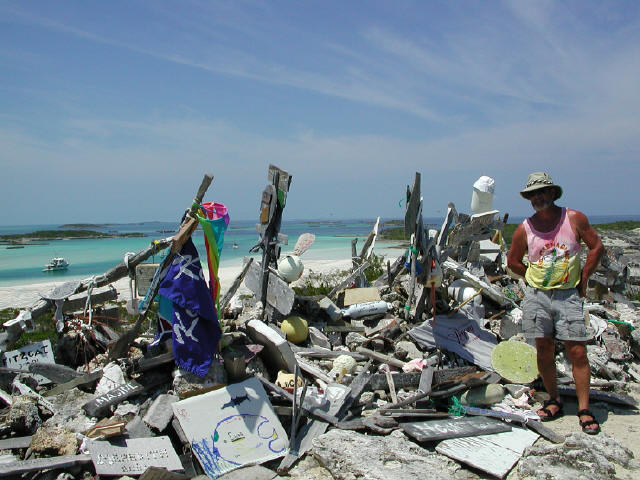
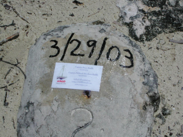
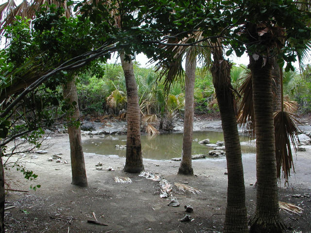
Land & Sea Park (Warderick Wells - south anchorage) waiting for the big
front to pass. Meanwhile there, we visited BooBoo Hill (left)
where all cruisers intriguing, albeit
ugly, prehistoric iguana (right). We then spent a week at Exuma
Land & Sea Park (Warderick Wells - south anchorage) waiting for the big
front to pass. Meanwhile there, we visited BooBoo Hill (left)
where all cruisers leave a remnant of their visit, and so we siliconed our boat card to a stone
and dated it (right); Pirates Lair (left), with it's
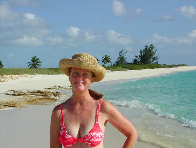
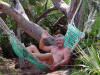
own fresh water spring, is where the pirates of old hid out; Steve
taking a break from his boat projects (right).
leave a remnant of their visit, and so we siliconed our boat card to a stone
and dated it (right); Pirates Lair (left), with it's
own fresh water spring, is where the pirates of old hid out; Steve
taking a break from his boat projects (right).
 Then
it Then
it
 was time for Debbie to try her hand at cutting Steve's hair - her first
ever attempt. was time for Debbie to try her hand at cutting Steve's hair - her first
ever attempt.
 It was going OK until Steve said it had to be shorter, then he grabbed the
mirror and scissors and went "chomp, chomp, chomp" (left).
He
It was going OK until Steve said it had to be shorter, then he grabbed the
mirror and scissors and went "chomp, chomp, chomp" (left).
He now
wears a hat. I'm not letting him near my hair. now
wears a hat. I'm not letting him near my hair.
 ARGO
at anchor (right) at Exuma Park - south anchorage, and north
anchorage (left). ARGO
at anchor (right) at Exuma Park - south anchorage, and north
anchorage (left).
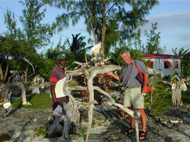
Further
down island at Black Point, Great Guana Cay, we meet Willie Rolle, self
proclaimed best artist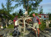 in the world and his
 Garden of Eden (right) -
a rather large collection of driftwood that resembles everything from
ballerinas to dolphins
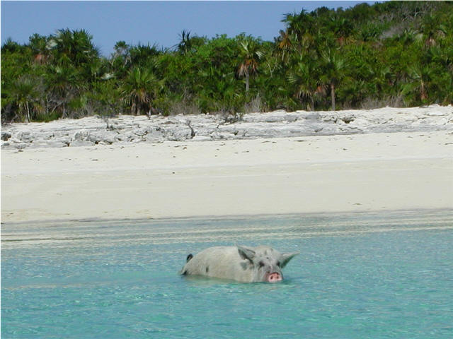
to boats - use your imagination. The one beach has a couple of pigs
that literally charge you dinghy if you get close to shore looking for food
(left).. Garden of Eden (right) -
a rather large collection of driftwood that resembles everything from
ballerinas to dolphins
to boats - use your imagination. The one beach has a couple of pigs
that literally charge you dinghy if you get close to shore looking for food
(left)..
Don't have too many more pictures,
but what follows is interesting enough.
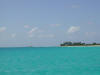
The Bahamas are made up of limestone
and coral, and are very low lying islands. The Bahama Banks
surrounding the islands are very shallow, and with the white sand give the
clear water the very light, turquoise color that it's known for.
However, it also makes for very tricky navigation: ARGO draws 6'3" so
many places we cannot go as it is too shallow, and we have to plan entering
and leaving some anchorages around high tide. Everyone runs aground
sooner or later, and our experience was over sand, not coral, and we were
able to get off quickly. It is also very important to be able to
visually "read the water", i.e., know how to read shallow vs. deep, sand vs.
grass vs. coral heads and reefs. The current is very strong between
islands and cuts, so it is necessary to plan departures and arrivals around
slack water to avoid the "rage" (east-moving current meeting the easterly
winds head on). We have been anchored many times where the boat is
dominated by the strong current over the strong wind. - really odd to have
the boat abeam to the wind when anchored. We have done night anchor
watches on several occasions due to strong winds (30 - 36knots), and the
flukey current has each boat swinging a different direction in the
anchorage. We now have more confidence on our anchoring strategy and
ability.
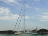
We have met many cruisers (both
sailboats and trawlers) and are loosely traveling with one boat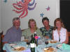 south, and a dozen others we keep meeting up with along the way. It's
a small world out here. It's great because we can help each other
navigate tricky waterways and can share know-how, and loan parts and tools
when necessary. We are able to stay in communication with them
via VHF radio (short distance) and SSB radio (long distance) via nets, or
relay through other boats. (At right: having dinner with Seanote
(Diane & Jim) at Sampson Cay)
south, and a dozen others we keep meeting up with along the way. It's
a small world out here. It's great because we can help each other
navigate tricky waterways and can share know-how, and loan parts and tools
when necessary. We are able to stay in communication with them
via VHF radio (short distance) and SSB radio (long distance) via nets, or
relay through other boats. (At right: having dinner with Seanote
(Diane & Jim) at Sampson Cay)
We have also met the Bahamian people.
They are very friendly, take pride in their work and are always there to
help you out. We're amazed at how many of these tiny islands have
their own RO water making systems, and everybody has DirectTV dishes.
There have been no personal security issues (except in Nassau there was a
report of theft from a cruiser). It's still very frustrating trying to
get stuff done. We have many boat projects to do, but the marine
stores and local knowledge is shockingly sparse. With Nassau and
George Town being big cruiser destinations, we were expecting some
selection, but have been told that we'll have to wait for Puerto Rico to do
our marine shopping and servicing. Just goes to show you that you have
to be pretty self-sufficient, and other cruisers help out. We have
been able to find fresh bread and a fairly good selection of produce along
the way. Our biggest mistake (friends had warned us) was not stocking
up on more beer before we left Florida. Kalik Beer (the Bahamian beer
that tastes like Natural Light or Corono and is good and the cheapest) costs
as much as $60/case. Other brands may be as much as $75/case. We
found Kalik here for $38/case, so have loaded up the aft cabin.
Cruising is hard work, and it would
be a lot easier going to the office each day. But not nearly as
interesting nor challenging! Most immediately, we are currently
dealing with a fuel problem. Another cruiser has lent us his portable
fuel polishing (cleaning) system which we have been running on our fuel
tanks for 2 days now. Eau de diesel fills the air. Just as we
were leaving an anchorage and were motoring out through a narrow cut in
confused seas, we lost our engine and were headed for the rocks. We
pulled out a the jib sail and managed to sail out from the rocks and back
into the anchorage, dropping the anchor under sail. Another lesson to
be learned is to always have your sail ready to be deployed, or up, when
maneuvering a hazardous passage. After our experience, the other 7
boats in the anchorage all had sails up when they subsequently left, so they
learned from our experience. The learning curve has been steep.
We have also had to deal with other things breaking or not working: fixed
the windlass in Nassau after manufacturer shipped replacement control box;
have issues with wind generator, monitor switch at helm and many
miscellaneous things.
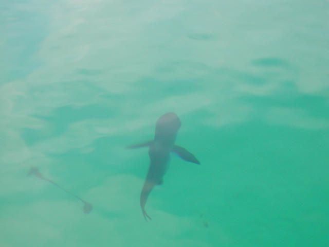
Because of the high winds and strong
currents here, we have not done much snorkeling. We did snorkel
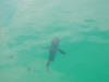 Thunderball Grotto,
Big Majors where Thunderball (James Bond) movie was filmed. We
went at low tide and slack current so we could swim straight in. It's
kind of like a volcano inside, with an opening at the top where the sun
comes in. There are lots and lots of beautiful fish and corals there,
both inside and out. While exploring the outside, Debbie ran into a 5
ft. shark. Although I have seen smaller ones from the boat, this was
the first in-the-water encounter. With women and children around, I
hesitated to yell shark. I yelled at Steve to drive the dinghy over to
get me. Not hearing a word I said, he just waves back at me and
smiles. So, Thunderball Grotto,
Big Majors where Thunderball (James Bond) movie was filmed. We
went at low tide and slack current so we could swim straight in. It's
kind of like a volcano inside, with an opening at the top where the sun
comes in. There are lots and lots of beautiful fish and corals there,
both inside and out. While exploring the outside, Debbie ran into a 5
ft. shark. Although I have seen smaller ones from the boat, this was
the first in-the-water encounter. With women and children around, I
hesitated to yell shark. I yelled at Steve to drive the dinghy over to
get me. Not hearing a word I said, he just waves back at me and
smiles. So,
 then
I have to yell "shark, shark". Someone said, must just be a nurse
shark. I don't care. At this point, a shark is a shark, so I
yelled again at Steve to come get me and he finally did. Looking up
the shark in my book later, it was a nurse shark, that likes to hang around
on the bottom and under ledges - like the ledge under my feet!
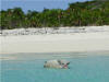
(This is NOT a picture of THE shark, but of a small nurse shark seen
from the boat - it shows how clear the water is!) then
I have to yell "shark, shark". Someone said, must just be a nurse
shark. I don't care. At this point, a shark is a shark, so I
yelled again at Steve to come get me and he finally did. Looking up
the shark in my book later, it was a nurse shark, that likes to hang around
on the bottom and under ledges - like the ledge under my feet!
(This is NOT a picture of THE shark, but of a small nurse shark seen
from the boat - it shows how clear the water is!)
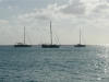
ARGO
at anchor.
|
|
|
|
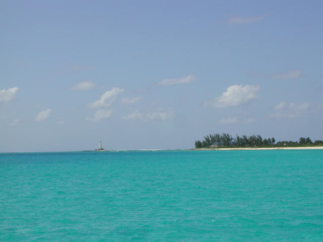
Landrail, Crooked I,
Exumas
[1]
[2]

[3]
[4] |
EXUMAS, BAHAMAS, cont'd - April 4 -
April 22: We spent about a week and a half in George Town, Exumas
alternating between the Volleyball Beach and Kitt's Cove anchorages,
although there are many other large anchorages here, too. We met Walt
here who is single-handing Wally World - he has joined Seanote and ARGO as we
have traveled south [1]. George Town is a very popular southern
destination for cruisers from Florida. It was almost too organized,
and social, for our liking. Again, we were shocked at the lack of
marine services and goods here, especially when considering the cruiser
population (400 boats in peak season, 100 when we were there).
We waited for a weather window and then headed south, on the move for 6
straight days until we got to the Turks & Caicos. Our stops along the
way included Rum Cay, Clarence Town (Long Island in the Ragged Islands),
Landrail (Crooked Island), W. Plana Cay and Mayaguana. Several times
we would leave an anchorage around midnight so we could maneuver tricky areas
(e.g., coral heads and reefs) in the proper sunlight conditions and make
distance before the high winds kicked up in the morning. We celebrated
Easter at Landrail with boat drinks ashore on the lovely white beach [2]
[3]. The next morning as Steve was pulling up the 2nd anchor, "snap",
the anchor rode (rope) broke. Even though we had anchored in sand,
apparently the anchor rode got caught around a coral head during the night
and chafed through about 35 ft. from the anchor. Another reason we
almost always set 2 anchors. (The primary anchor is all chain, so
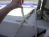
chafing on coral is not a problem with it.) Using our Position Report
from the night before, and our Nobeltec charting software, we estimated
where the lost anchor might be located. Walt had dive gear handy and
dove down, eventually rescuing the anchor and saving the day. Thanks,
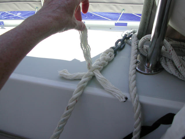
Wally World! In transit that day, we cut off the chafed rode and
spliced the rode to the anchor - making use of what we had learned in
Splicing 101 [4].
From Mayaguana, we left the Bahamas
behind and headed to the Turks and Caicos.
 Landrail with lighthouse on reef
 |
|
|
[ Home ] [ Up ] [ Next ] [ Top of page ]
|