|
[ Back ] [ Home ] [ Up ] [ Next ]
|

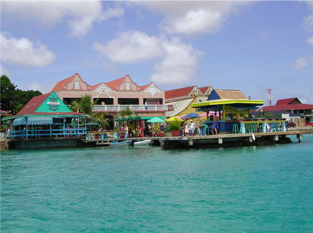
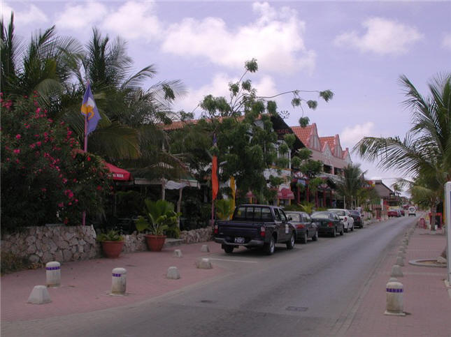
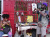
Charming main town - brightly
painted, clean
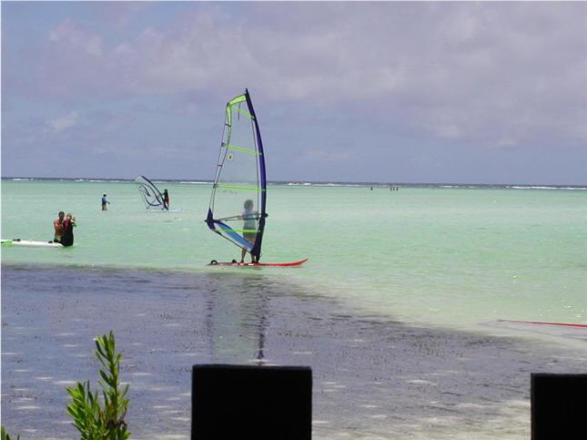
Shallow Lac Bay: The place for
windsurfing
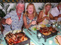
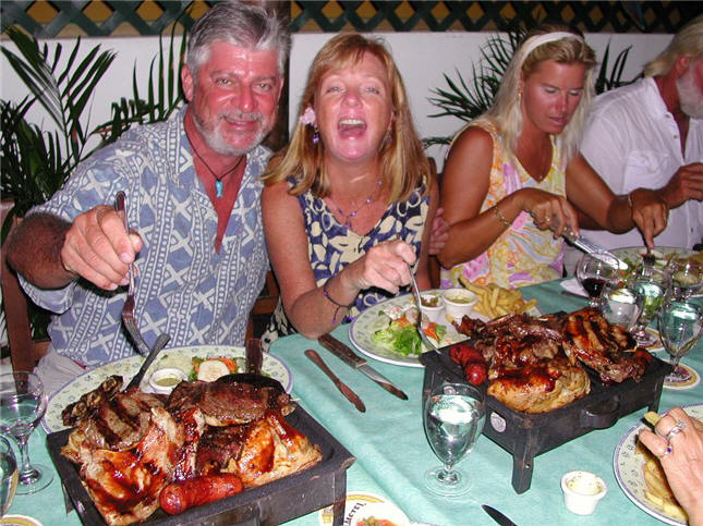
Group dinner: our one order of mixed
grill (8 diff. meats) fed us
for days on our passage |
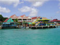
BONAIRE,
NETHERLANDS ANTILLES - APRIL 26 -
MAY 4, 2005: A
day passage from Las Aves, Venezuela takes us into this
renowned diver's paradise.
Bonaire is part of the ABC Islands
and is Dutch (as is Sint Maarten,
Saba and Statia), although English
and US$ are widely used here.
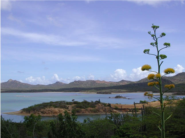
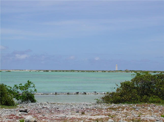
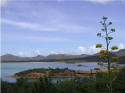
Bonaire (20 x 5
miles) is another dry, desert-like
island: cactus- and scrub-covered hills on the north side and vast
salt ponds on the flat south side.
Bonaire's economy is dependent
primarily on salt and tourism,
especially diving. The island
is surrounded almost entirely by a
narrow 15-30 ft. deep shelf,
that drops off suddenly to greater
depths. To the eye, the island
is perfectly outlined in light
turquoise. Bonaire is
extremely environmentally conscience
and as a result no anchoring is
allowed. Well-maintained
moorings are available off the main
town of Kralendijk, for a small fee,
which we pick up. The town is
a contrast to Venezuelan towns: it
is very clean, safe, neat, and
definitely a tourist/resort area.
We are impressed with this
diving mecca, as there are about 80 well-marked dive
sites surrounding the west coast
with mooring buoys (for dinghys or
small boats) and road access.
One can literally dive off the back
of your boat on the reef wall.
The area has lots of fish and the
coral reefs are in good shape.
We rent a jeep and check
out the island. We marvel at
the thousands of pink flamingos
living in the 2 large lagoons on
either end of the island. We
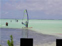
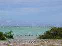
visit Lac Bay, about a 6 sq.
n.mi. sand-bottom bay on the windy
east side with an average depth of
only 2 or 3 feet, which is used
almost exclusively for windsurfing,
an ideal spot to learn the sport.
With a bunch of other cruisers, we
venture into a nearby town for the
holiday celebration of the Queen's
Birthday, with cheap, cold beer and
street food. (During our one
week here, Bonaire celebrated 3
separate holidays.)
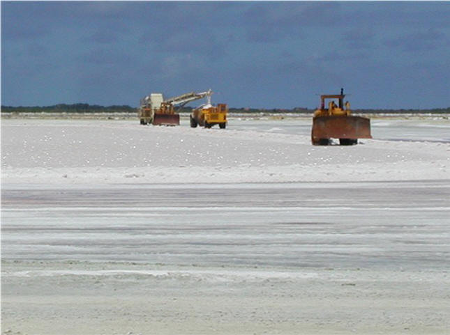
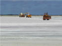
The south end of the island
is dominated by salt: Salt pens
(ponds) stretch for miles laid out
on giant squares, varying in color
from pastel blue-green to pink
depending on the drying stage.
The areas where the salt has dried
look like huge sparkling ice skating
rinks, bulldozers at work scooping
up. Giant mounds of salt stand
ready for transportation by ship
back to the Netherlands.
We top off with US$3.20/gal
diesel (had been US$4.00/gal the day
before). This, of course, is
in stark contrast to the 10
cents/gal we bought in Venezuela.
Let's hope for good wind so we don't
have to motor!
- -
-
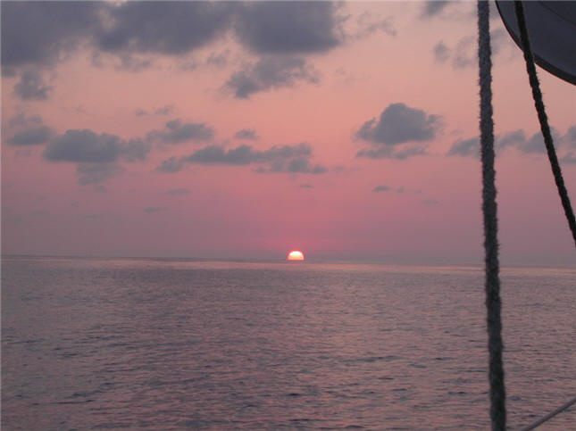
PASSAGE: The time has come to turn
northwest for the rest of the
journey back to Texas, with only 3
island stops available in between
for rest and fueling: Jamaica,
Grand Cayman and Mexico (Isla
Mujeres). All in all, this is
not a well-traveled route and
traffic is at a minimum, seeing
no other sail boats and only a
few freighters, usually at night and
many miles away on the radar.
We have
friends, still in Bonaire, who now
start sending us internet weather
information via email to fill in
what we are able to get ourselves
(from email and SSB weather nets).
We check in on the Caribbean
Maritime Net in the a.m. and to the
Cocktail Weather Net in the p.m.,
although as we get further north the
propagation has become weaker.
We also send Position Reports each
day to report our lat/long position
(links on our website). We
also are in daily email contact with
friends in Venezuela, Bonaire and
Houston who are closely following
our progress. These are all
resources we routinely use,
but with such a long passage(s) we
are more diligent with it.
That's a nice thing about the
cruising community, everybody
watches out for each other.
|
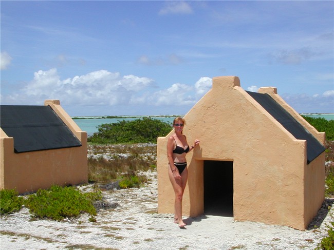
North side:
Hilly desert . . .
South side:
Flat; salt pens for evaporation;
dried salt flats; salt ready for
shipping;
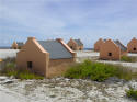

and old
slave huts - notice how small they
are |
|

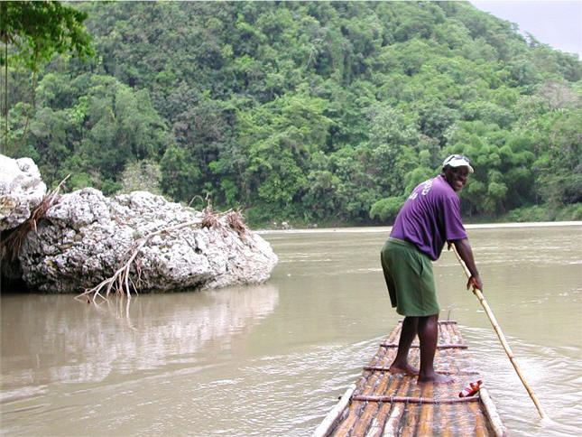
Austin guiding our "banana" raft
down river
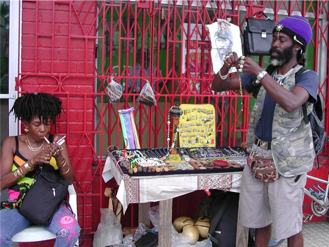
Tonkie (standing) making Deb's ankle
bracelet;
"Yah mon, it's definitely 'you'". |
JAMAICA, MAY 8
- 14: A surprisingly
fast passage with good winds,
although rolly seas, had us
averaging 150 n.mi./day and put us
in Port Antonio, northeast
corner of island, after 4
days/nights. Jamaica is a
large mountainous island,
reminiscent of such islands as
Dominica, Dominican Republic, St.
Lucia, Trinidad, etc.. Clouds
hang over the island, producing the
first rain fall we have seen in
almost 5 months, and a free
boat wash which excited us - it's
the little things! As it
turns out, rainy season has just
begun here and we experience some
rain most days - a welcomed relief
from the hot, cloudless skies we
have been accustomed to for the last
many months. Locals couldn't
understand why we were so thrilled
to see the rain clouds.
Port Antonio is a
charming and picturesque area.
We treat ourselves and get a slip at
the Port Antonio Marina to help us
rest up for what lies ahead.
This is probably the nicest marina
we have seen on our travels and
liken it to Waterford Marina in
Houston/Kemah. Nice secured
grounds and park area, and the town
just a couple minute walk away.
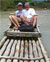
For a brief glimpse of the island's
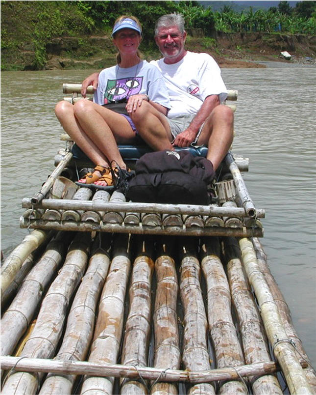
interior, we take a river raft trip. These rafts are
very long and narrow, made of
bamboo, and were originally used for
transporting banana crops. Our
guide, Austin, enthusiastically
explains their use, and the training
program the guides must go through,
starting with an apprenticeship of
bringing rafts back up the
river after use.
As Jamaica is 140
miles in length from east to west,
we do an overnight trip from Port
Antonio (east) to Montego Bay,
located on
the western part of the north coast,
to stage for our next passage.
Not sure what all the hubbub is
about Montego Bay - it's a huge bay,
with the town and resorts scattered
on the high hills bordering the bay,
water light blue only near shore.
We anchor at the only feasible
anchorage which is at the Montego
Bay Yacht Club. A $15 taxi
ride is the only way to the town of
Montego Bay (or a very long, wet
dinghy ride). In all fairness,
it was rainy the day we went to
town, so did not get to look around
much. We wanted to visit the
Bob Marley Experience (no, not what
you're thinking) with video
presentations but a mudslide had
closed the road.
We also wanted
to make one more stop before leaving
Jamaica, one that would have put us
even further west for jumping off.
However, due [again] to myopic
government regulations, we would
have to return back to
Montego Bay to clear out. That
would have defeated the purpose of
staging further west, so had to
forego the additional stopover.
(That is one of
the more frustrating aspects of
cruising we have encountered.
The frequent bureaucratic,
labor-intensive paper-shuffle,
runaround and unreasonable
restrictions, give locals "power"
over you which many relish.
Even when they collect no fees
(e.g., customs, immigration, and
less often port captain,
agriculture, health/sanitation,
etc.....) it still can be a big
hassle. The French islands are
the best, as they don't collect fees
and really don't care where you've
been or where you're going. In
all fairness, the officials are
usually very nice, just doing their
job.)
- -
-
PASSAGE: In Jamaica, we
have seen only 3 other cruising
sailboats here, all headed to the
Bay Islands of Honduras. After
several nights in Jamaica, we make a
2-day/night passage, a mixture of
sailing and motoring, to Grand
Cayman Island. We're suppose
to be picking up the helping current
along this route, but seemed like we
encountered adverse current, up to 1
3/4 knots, most of the way. We
were able to reactivate our XM radio
via email, which now helps to keep us entertained on
passage-making.
|
Port Antonio:
pretty little beach area
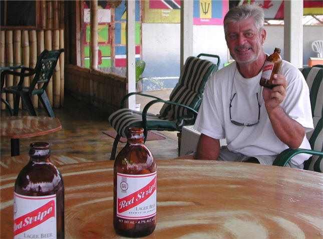
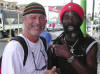
Steve discovers
another new beer: Jamaican
Red Stripe |
|
GRAND CAYMAN
ISLAND - MAY 16 - 21: We arrive
at George Town, Grand Cayman Island, a flat, dry
place on a holiday, Discovery Day.
(It's incredible all the holidays Caribbeans have, any excuse for a
day off - this impacts our clearing
in/out of countries, not to mention
everyday stuff.) With their
permission, we stayed quarantined on
ARGO for the day avoiding hefty
overtime/holiday charges for customs
and immigration. We have a
heck of a time anchoring off the
town, trying to hit a spot of sand
among the low coral reefs. A
nearby cruiser tells us they will
fine you big time if your anchor is on
coral so we re-anchor several times
'til we get it right.
Grand Cayman is
known for being an international
financial center (there's something
like 600 financial institutions on
this small island, popular because
they protect identity
of bank account holder), a tax-free
haven, and for tourism, especially
diving. Frankly, it wasn't
anything like we were expecting -
meaning it's pretty non-descript.
Many of the mega-yachts we have seen
in the Caribbean are flagged/documented here,
but have probably never been here
even for a day! We only saw one such yacht in
person here. This is, however,
a popular day stop for the large cruise
ships, seeing up to 5 in one day.
The shopping area is quite nice,
lots of jewelry stores, but
overpriced as expected. Many
affluent own condo property,
exorbitantly priced.
Grand Cayman
was hit directly by hurricane Ivan
last September and it is still quite
evident: Lots of large trees
and vegetation piled up all over,
many hotels and condos have not
reopened. Being a flat island,
water covered much of it.
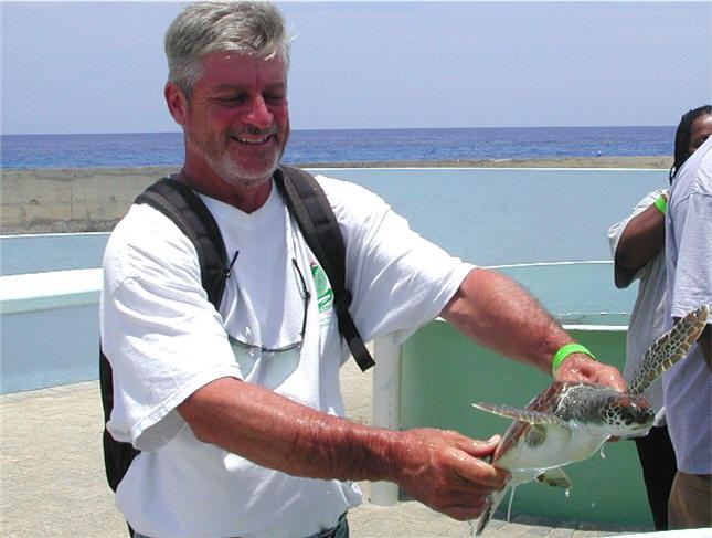
Sightseeing onshore, we saw
the turtle farm (for both the
preservation of the species and for
the tasty soup bowl) with a few thousand
large green turtles. A visit
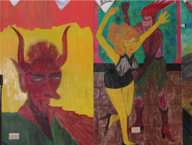
to the town of Hell consisted of
a weird volcanic-like rock swamp,
named from some former political
figure who when bird hunting here missed a
bird and said "Oh hell". Hmmm.
Planning a morning
departure after a couple of nights
here, we download weather to find
out about tropical storm Adrian,
escalating to a hurricane in the
Pacific. It's forecasted to
come right over the top of Grand
Cayman, quite possibly affecting the
area en route to our next and final
intermediate stop, Isla Mujeres,
Mexico. Quite concerned, we
delay departure and follow it
closely. Anchored on the west
side with no protection, we would
incur the full brunt of the storm
should it come this way. We,
and the 2 only other cruising boats
here, decide to move into the North
Sound, a huge 25 x 25 mile shallow
bay, bordered by reefs on the north
side. The one boat had been in
there before and showed us the way.
Lesson learned, always follow your
own navigation, we know
better. He took us in the
"wrong" cut and we ended up in
shallow-than-expected depths, down
to
6 ½ ft. - we draw
6 ½ ft. -
but sand bottom, thank heavens.
We sit behind the reef in this vast
area with no clue where to go.
(The chart for Grand Cayman is VERY
outdated and of very little use).
We flag down a fisherman who leads
us into a very nice development and
marina area (marina partially
destroyed by Ivan) where we anchor. This is
when we learn that we had come in
the "wrong" cut. We are given
guidance for our return trip out the
next day through the "main" channel
(a whopping 8 ft.),
as Adrian fizzled out over Central
America.
- -
-
PASSAGE:
We take off on this leg to Mexico,
not sure if we will arrive in 2 or 3
days. Once again, there is a
current that flows westerly that
should assist us, but we never
really find it, fighting a current
up to 2+ knots much of the way.
As winds are again light, we have to
motor the whole way, fighting the
current.
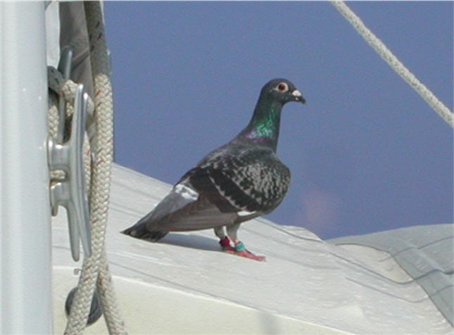
During the first night we pick up a
hitch-hiker. A pigeon keeps
circling our boat and finally lands.
 In the
morning, we see that his legs are
banded for "navigation" - left leg
with a red tag and right leg with a
green tag! Steve tries to shoo
him away (he's already pooped on the
deck) but Deborah intervenes as he
apparently is pooped himself.
After he rests a bit, Deborah uses
the hose to give him water which he
drinks, and then takes a shower.
He stretches his legs occasionally
by flying around but returns.
The next night he takes off,
apparently smelling land close
enough. Not sure if he was
headed to Cayman, Cuba or Mexico. In the
morning, we see that his legs are
banded for "navigation" - left leg
with a red tag and right leg with a
green tag! Steve tries to shoo
him away (he's already pooped on the
deck) but Deborah intervenes as he
apparently is pooped himself.
After he rests a bit, Deborah uses
the hose to give him water which he
drinks, and then takes a shower.
He stretches his legs occasionally
by flying around but returns.
The next night he takes off,
apparently smelling land close
enough. Not sure if he was
headed to Cayman, Cuba or Mexico.
|
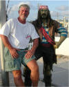
Making new friends

Turtle farm;
they really pack them in

Bar art work in
Hell |
|
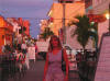
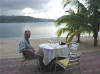
Lively
restaurant/ bar street
A beach/
restaurant/ bar area
|
ISLA MUJERES,
MEXICO - MAY 23 - 25: This is a long,
thin flat island just offshore Cancun and
north of Cozumel. Here we find
lots of cruisers, many staging to go
back to Florida before hurricane
season, and others heading down to
Belize and Honduras. This is
an active cruising community and we
would have liked to stay longer.
We met a cruiser from Port Aransas,
Texas who knows several cruisers
that we know. It is a small
world!
We had planned on stopping here only
to refuel (we'll need full fuel
tanks if we have to motor across the
Gulf of Mexico), and perhaps avoid
clearing in, but that wasn't to
happen as customs was there to greet
us when we pulled up to the fuel
dock. Of all places we've
been, this has probably been the
worse with respect to clearing
in/out procedures: It is
required that we use an agent
(US$150) to clear in/out; a US$50
fee is paid to the port captain; it
took 22 hours for us to clear
in/out; AND, in spite of using an
agent, we had to go in person twice
to the immigration office.
Above, I mentioned the bureaucratic
paper-shuffle: Here, we had to
supply 12 copies of the Crew List
and 6 copies of the Zarpe (clearing
out) forms that we had to
generate on our computer - what they
do with all those forms I'm sure no
one knows. So,
our 1-day turn-around didn't happen.
We did check out the town and get a
feel for this nice but laid back
place. We also got some really
good Mexican food! Cruisers
tend to really like it here.
|
|
PASSAGE: We continue
northwest through the Yucatan
Strait, where again helping currents
up to 2 knots are suppose to flow
(this is where all the water from
the Caribbean "squirts" through the
narrow Straits up into the Gulf of
Mexico, part of it
heading east to the Florida
Straits). Well, all we saw was
a 1-knot current for a short ways,
then, you guessed it, it turned
against us. So, we are
currently having to motor. As
we depart, a full moon keeps us
company. Our passage
across the Gulf of Mexico is close
to 700 miles.
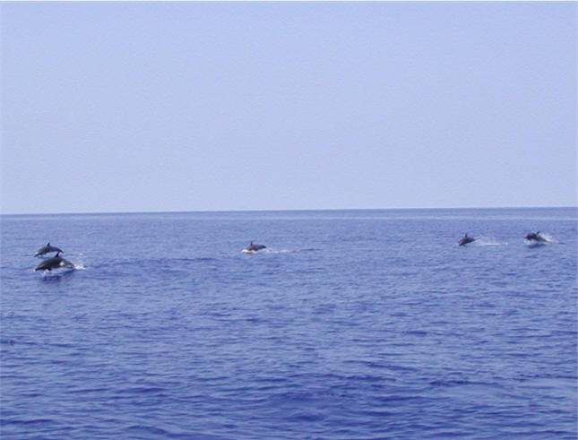
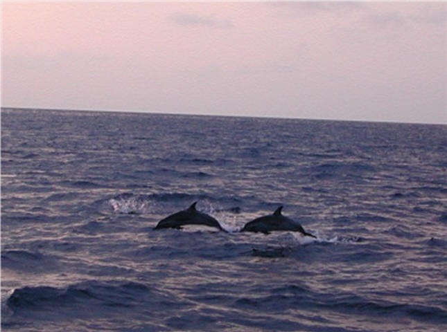
On day 3, in the
middle of the Gulf, the seas are
smooth as glass (no wind).
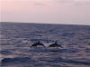
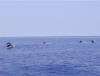 We hear splashing and look
out to see dozens of dolphins racing
towards us, We hear splashing and look
out to see dozens of dolphins racing
towards us,
 jumping wildly. They
obviously had found a source of
entertainment as they took their
place at the front of ARGO to ride
our bow wake, a customary practice
for dolphins. The water is so
clear and calm we can easily see
them swimming, some on their sides.
Eventually they left, only to return
later for more fun (for us). jumping wildly. They
obviously had found a source of
entertainment as they took their
place at the front of ARGO to ride
our bow wake, a customary practice
for dolphins. The water is so
clear and calm we can easily see
them swimming, some on their sides.
Eventually they left, only to return
later for more fun (for us).
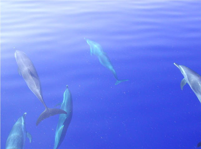
Day 4, conditions are still light
and we continue to motor.
 Deborah is in the cockpit
with her computer working on this
website update. The breeze is
variable today and we have switched
the sails from side to side more
than we can count. More
dolphins greet us, several jumping
out of the water belly-flopping.
One in particular, jumped at least 3
feet, curved his body into a "C" and
cannon-balled with a huge splash
directly in front of the boat.
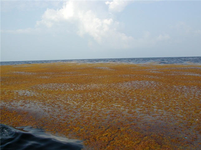
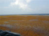
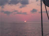
(Picture above: Sargasso?
"fields" floating way out.) Deborah is in the cockpit
with her computer working on this
website update. The breeze is
variable today and we have switched
the sails from side to side more
than we can count. More
dolphins greet us, several jumping
out of the water belly-flopping.
One in particular, jumped at least 3
feet, curved his body into a "C" and
cannon-balled with a huge splash
directly in front of the boat.
(Picture above: Sargasso?
"fields" floating way out.)
Still a couple of hundred miles from
land, and still in deep water,
during the night we see our first
drilling platform. It is a
monstrously huge Eiffel Tower-like
structure, whose multitude of bright
white lights we see glowing above
the horizon 30 miles off.
Within 8 hours, as we get into
shallower waters (200 ft.),
 we'll
be in the rig field: Lots and
lots of drilling rigs, production
platforms, crew/supply boats,
freighters, tankers, etc. so we'll
have to be alert. People are
always amazed at how colonized these
waters are, even this far out.
(I had planned on taking pictures of
this, especially at night when they
are lit up like cities, but as
you'll see below, we were rather
busy with other things.) At
night, depth perception is not good,
so radar is essential for
determining where each lays and what
direction, if any, it is moving.
We've done this many times before,
so this is familiar to us.
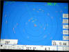
(Picture above: Radar screen
showing "targets" - each yellow line
is a target - either a stationary
rig/platform, or moving
freighter/tanker/boat. Each
ring is 3 miles wide. As we
get closer to land, the screen fills
up with even more targets.) we'll
be in the rig field: Lots and
lots of drilling rigs, production
platforms, crew/supply boats,
freighters, tankers, etc. so we'll
have to be alert. People are
always amazed at how colonized these
waters are, even this far out.
(I had planned on taking pictures of
this, especially at night when they
are lit up like cities, but as
you'll see below, we were rather
busy with other things.) At
night, depth perception is not good,
so radar is essential for
determining where each lays and what
direction, if any, it is moving.
We've done this many times before,
so this is familiar to us.
(Picture above: Radar screen
showing "targets" - each yellow line
is a target - either a stationary
rig/platform, or moving
freighter/tanker/boat. Each
ring is 3 miles wide. As we
get closer to land, the screen fills
up with even more targets.)
Day 5 seas become lumpy as we enter
the outer-lying Safety Fairway,
still about 100 miles from land.
The Safety Fairways are essentially
designated thoroughfares that run
through the middle of the rig field:
No fixed structure can lie in this
area so it is a safe passage for
freighters/tankers coming or going
from Galveston/Houston.
Although we can go any direction we
want, we use the Fairway in lieu of
dodging rigs/platforms.
Our last night out before returning
to Texas turns out to be the worst
weather we have experienced since
leaving over 2 years ago. Late
evening, as we enter the inner-lying
divided Safety Fairway, we hear a
Coast Guard announcement on the VHF
that a huge and dangerous
thunderstorm will be passing over
our area around midnight, expect 50
knot winds and possible hail.
Oh great. We have a couple of
hours to take sails down, secure
lines and whisker pole, add diesel
to our fuel tanks (from gerry cans),
get additional safety gear out and
ready, etc. Meanwhile, we are
having to keep a sharp eye out for
freighter/tanker traffic:
These vessels are huge and fast
moving, sometimes seemingly
appearing out of nowhere, and they
cannot easily maneuver - it's up to
us to get out of their way. As
midnight approaches, so does a long
line of hyper-active thunderstorms,
with giant vertical bolts of
lightning going all the way to the
ground/water. The lightning
storm passes over us - and sits
literally on top of us for almost an
hour. We are below (no sense
in getting fried topside) watching
radar (we can make out most rigs to
our starboard side) and our chart
plotter (we can see our position in
the Fairway, hugging the right
side). Not only do we fear
getting struck by lightning, which
we thought was inevitable, but we
are also fearful of being run over
by a freighter/tanker, as they may
not be able to see our little blip
on radar in the midst of the
lightning storm. We will make
no bones about it, lightning is a
very scary thing to a boater - there
is nowhere to hide from it, and if
struck damage can be catastrophic.
The storm eventually passed
miraculously without any damage -
saw 30 knot winds, rain but no hail.
We continue up the Fairway towards
the jetties at Galveston. This
now becomes quite stressful (in a
different way) because there are so
many lights out here that it is very
confusing at night. But with
radar, chart plotter and GPS
waypoints, we confidently make our
way into the jetties and up the
Houston Ship Channel, past several
"interchanges" avoiding long lines
of towed barges and other big
traffic. Sunrise greets us
just before we reach the Galveston
Bay cut. We enter Watergate
Marina and tie up to a slip at 8:30
Monday morning, after dredging their
muddy channel at low tide.
What a finale the last 12 hours of
our trip has been!!! |
|
 |
HOUSTON,
TEXAS - MAY 30, 2005:
We are now at Watergate Marina in
Kemah (Clear Lake / Houston).
We have 5 days to unload all our
personal items before ARGO is
decommissioned and trucked back to
the Valiant factory (north of
Dallas) on June 5-8. We also
have to arrange for rental car,
phone, packing boxes, etc., etc.
A really big job lays ahead of us.
It's unbelievable how much stuff we
have managed to put on ARGO - her
waterline has risen as we take
things off. Hopefully we'll
remember this when it's time to
reload her! |
 |
|
|
 |
|
|
|
 |
|
[ Back ] [ Home ] [ Up ] [ Next ]
[ Top of page ]
|