|
[ Back ] [ Home ] [ Up ] [ Next ]
|
Cursor over pictures to
display caption; click to enlarge then close out of that window. |
|
|
|
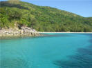
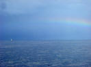
 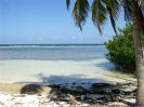 BELIZE,
February 2008:
After leaving the Rio Dulce river in Guatemala (with a
relatively
stress-free bar exam), we hung out in Placencia, a favorite of cruisers,
for a month. We arrived on Valentines Day, which gave us 2 days to
buy and eat fresh lobster
before the season
closed, and so we did!
It's easy to get "stuck"
here, but we did check out BELIZE,
February 2008:
After leaving the Rio Dulce river in Guatemala (with a
relatively
stress-free bar exam), we hung out in Placencia, a favorite of cruisers,
for a month. We arrived on Valentines Day, which gave us 2 days to
buy and eat fresh lobster
before the season
closed, and so we did!
It's easy to get "stuck"
here, but we did check out  some new cays
- Wippari Cay and South Water Cay.
We had planned on stopping at Belize's
offshore atoll Glovers Reef, but
forecasted strong north winds and equally unpleasant seas over the next
several days told us we'd better get to Roatán while things were still
rather calm. An overnight passage put us into French Cay on Roatán,
one of the Bay Islands of Honduras. some new cays
- Wippari Cay and South Water Cay.
We had planned on stopping at Belize's
offshore atoll Glovers Reef, but
forecasted strong north winds and equally unpleasant seas over the next
several days told us we'd better get to Roatán while things were still
rather calm. An overnight passage put us into French Cay on Roatán,
one of the Bay Islands of Honduras.
- - -
The
BAY
ISLANDS
OF HONDURAS
consist of 3 islands lying to the north of mainland Honduras: West to east
they are Utila, Roatán and Guanaja. Each is very unique:
Roatán is a world-class but very affordable dive haven and tourist
destination; flat and almost desolate Utila with its good diving but less
amenities appeals more to the budget-minded backpacker; and Guanaja,
isolated and off the beaten path, is in it's own world, with basically only
boat and foot traffic.
While Honduras is a
Spanish speaking country, a large percentage of the inhabitants of the Bay
Islands speak English and Spanish. English was brought here by Grand
Cayman settlers. Also, the majority of the population is Seventh Day
Adventist, which means that businesses (including stores, restaurants/
bars) are closed on Saturday. Makes it tough on the tourist!
- - -
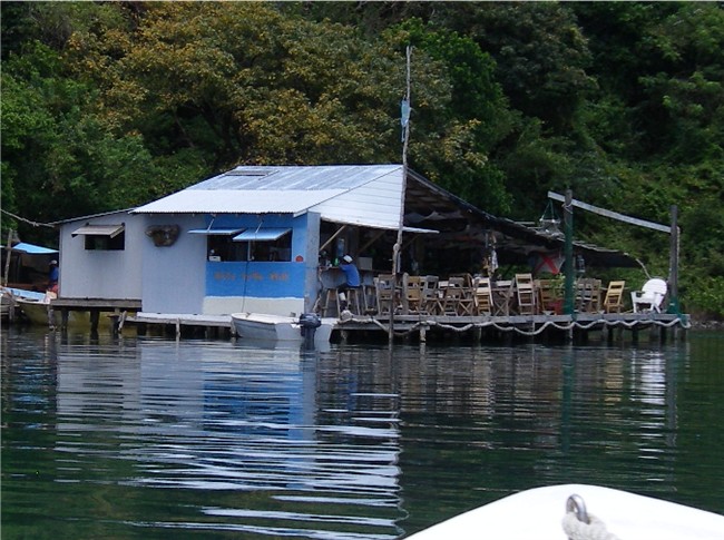
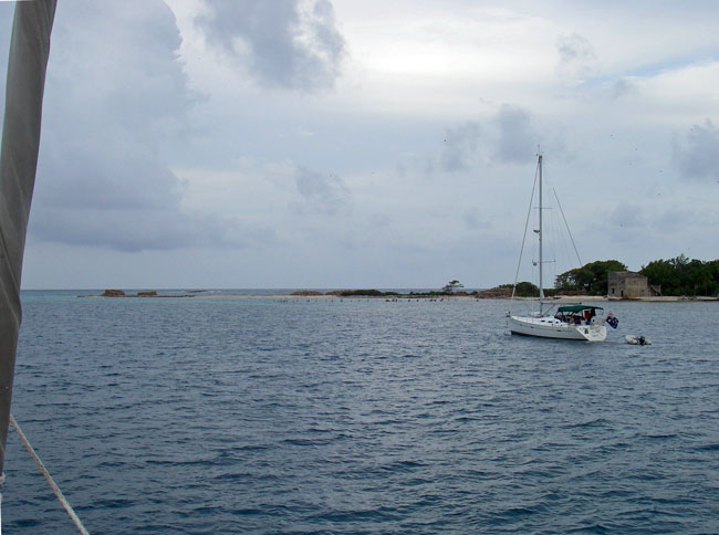
|
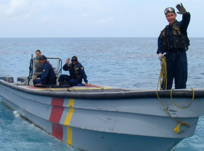
KA-CHING
KA-CHING
We may have
to spend some extra time in Roatán collecting all our royalties!
When we
cleared in to Roatán, the port captain gave us, as a matter of
routine, a brochure promoting the use of mooring balls at Sandy
Bay. And there is ARGO front and center on the cover!
Oddly enough, we'd never been to Sandy Bay and have never used a
mooring ball in Roatán. Upon further inspection, we
recognize the anchorage as being French Cay, and a fake-looking
mooring ball has been superimposed in front of ARGO!
A couple of
weeks later, we run into ex-cruisers who now live and work in
Roatán. They hand us their business brochure, and there's a
photo of us as "very satisfied customers"!
And lastly,
ARGO's bow provided the setting for a vacationing couple to renew their wedding vows. We rounded up our crazy cruising friends in
Jonesville, hit the 2
floating bars
 and
I know
provided the "newly weds" with indelible lasting memories! and
I know
provided the "newly weds" with indelible lasting memories! |
|
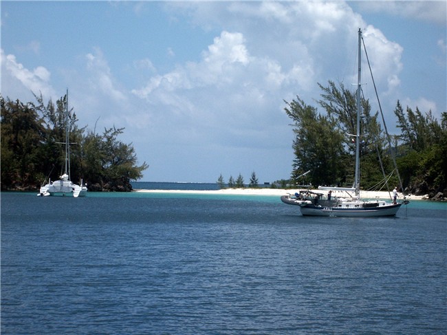
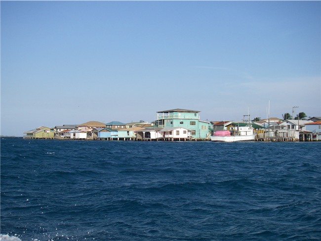
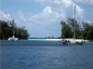
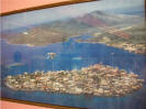
 ROATAN,
HONDURAS,
March, April 2008:
We spent a couple of months in Roatán last year -
and loved it. So far, we've been in French Cay, and anchored in the
"lagoon" (top center of ROATAN,
HONDURAS,
March, April 2008:
We spent a couple of months in Roatán last year -
and loved it. So far, we've been in French Cay, and anchored in the
"lagoon" (top center of
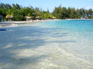 picture on left) for the
northers that
still pass through. The
Fantasy Island Dive Resort
is
right here, and we are able to use their beaches, pool and common areas,
wifi internet and bar. A dinghy ride, or taxi ride, puts us at
French Harbor settlement for excellent grocery shopping, fuel, great pizza
and more. Life is good and easy here, so we are taking advantage of
this great anchorage. picture on left) for the
northers that
still pass through. The
Fantasy Island Dive Resort
is
right here, and we are able to use their beaches, pool and common areas,
wifi internet and bar. A dinghy ride, or taxi ride, puts us at
French Harbor settlement for excellent grocery shopping, fuel, great pizza
and more. Life is good and easy here, so we are taking advantage of
this great anchorage.
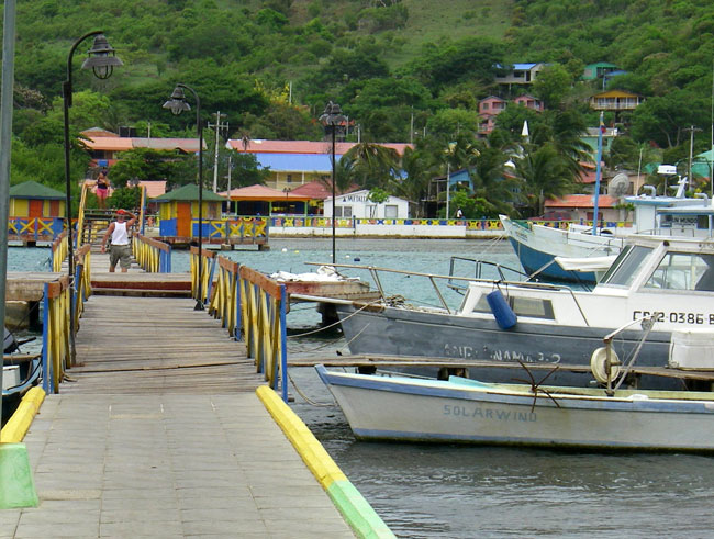
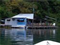
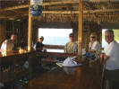
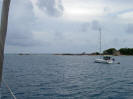
 We
have also spent some time in Jonesville / Bodden Bight again. This
community is accessible only by water and spans several bights (harbors).
Commuting
done by dinghy, lancha and water taxis are either through broad deep
canals (also used by large shrimping/ fishing boats) bordered with stilted
houses We
have also spent some time in Jonesville / Bodden Bight again. This
community is accessible only by water and spans several bights (harbors).
Commuting
done by dinghy, lancha and water taxis are either through broad deep
canals (also used by large shrimping/ fishing boats) bordered with stilted
houses
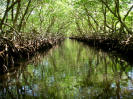 over the water, or through narrower and shallower canals lined with
thick mangroves. over the water, or through narrower and shallower canals lined with
thick mangroves.
Updates on Roatán
since last year: Electricity, or rather the lack thereof, has become
a really big problem for Roatán. This time, we've met quite a few
business owners whose businesses are compromised because of
unreliable/inadequate power. Everyone from the enterprising young
man doing our laundry, to the lady who makes bread and pastries, to the
shop owner catering to tourists (i.e., big cruise ships) and on and on,
are complaining openly. Our heart goes out to all these people
trying to make an honest living - but governmental "circumstances" get in
their way. The latest is that an American has bought the electric
company here.
Roatán is a big
tourist destination, especially for outdoorsy and water-sport adventurers.
The island (Roatán) has three canopy zip lines (those things where you go
buzzing through the tree tops on a cable). A few days ago a zip
cable broke, sending a young woman to her death. The initial story
blamed one thing, but from an inside source we were told that a cruise
ship company refused to go along with the cover-up, so the truth is now
out - at least in the inner circles. All zip line companies have
closed temporarily and all are now installing double cables.
Probably the best QC method, however, is to send the owner zipping down
his own line first thing each morning!
|
A
DIFFERENT MENTALITY
During
our 2 years in Central America, we have seen many cultural
differences. One difference that still confounds the
foreign traveler is the way that the general population is not
taught to think beyond the present. The following
vignettes are true examples of what we have experienced.
-
- -
|
An ex-pat living in Roatán asked a grocery store owner
to order a product he knew others also wanted. The
owner bought 2 cases, 24 units in each, of a product and
put them on the shelf. Word got around quickly and
within a day or two it was completely sold out.
|
Ex-pat:
"Wow, this item really sold out fast!" |
|
Owner:
"Yeah, I'll never buy that product again," he said
grumbling |
|
Ex-pat:
"Why not?" |
|
Owner:
"Because it sold out too fast. It's too much
trouble to keep it in stock." |
|
-
- -
|
A
well-established ex-pat Business Woman (BW) in Antigua,
Guatemala, asked her assistant to book a hotel room for
her. Days later when she followed up with
her assistant about the reservation, she was informed
that the hotel was full.
|
BW:
"Did you book me a room at another hotel?" |
|
Asst:
"No. You didn't tell me to." |
|
BW:
"Then, why didn't you tell me the hotel was full?" |
|
Asst:
"Because you didn't tell me to tell you if the hotel
was full." |
|
-
- -
|
One of the best grocery stores in Roatán (lots of
American brands and variety) prides itself on it's
'cereal' aisle, which I must admit is colorful and
always meticulously fully stocked. The reason:
They sell very little cereal, thus very little attention
and maintenance is required! (Be sure to check
those expiration dates!) |
|
|
Soon we will be
moving on to the eastern-most Bay Island of Guanaja. There, we will
stage and wait for weather before making our way south to Panama.
There are several islands on the way, so we'll be able to hop down doing a
few overnight passages. Our first destination in Panama will be
Bocas del Toro.
For more pictures
and update on the Bay Islands of Honduras, see our update from Spring 2007
on Pictures/Journal page 24.
- - -
  GUANAJA,
HONDURAS, May 2008:
Guanaja, the eastern-most Bay Island, is almost off the radar. There
is little commercial transportation (airport, ferry) to this island and thus
hardly any tourist traffic. About the only visitors are cruisers,
the majority of who, like us, are staging here waiting for favorable
weather in heading to, or coming from, Panama and Colombia. GUANAJA,
HONDURAS, May 2008:
Guanaja, the eastern-most Bay Island, is almost off the radar. There
is little commercial transportation (airport, ferry) to this island and thus
hardly any tourist traffic. About the only visitors are cruisers,
the majority of who, like us, are staging here waiting for favorable
weather in heading to, or coming from, Panama and Colombia.
   Guanaja
is surrounded by reefs. It is a hilly island (highest point 1,600
ft.), 11 miles long by 4 miles wide, with a total population of about 10,000. Because of expected
high east-southeast winds, we made our initial landfall on the northwest
side of the island at Michael Rock. We are anchored inside of the
long reef, tucked behind the hills and big rock. We see sand beaches
and turquoise water scattered all around us. In this area, there are
a few secluded houses, a handful of Honduran weekend visitors to the beaches, and lanchas (private and water taxis) making daily trips through the
intra-island canal. Guanaja
is surrounded by reefs. It is a hilly island (highest point 1,600
ft.), 11 miles long by 4 miles wide, with a total population of about 10,000. Because of expected
high east-southeast winds, we made our initial landfall on the northwest
side of the island at Michael Rock. We are anchored inside of the
long reef, tucked behind the hills and big rock. We see sand beaches
and turquoise water scattered all around us. In this area, there are
a few secluded houses, a handful of Honduran weekend visitors to the beaches, and lanchas (private and water taxis) making daily trips through the
intra-island canal.
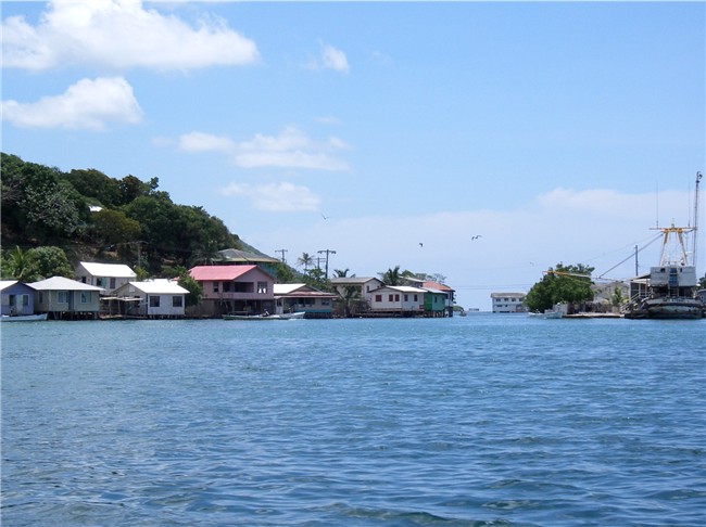
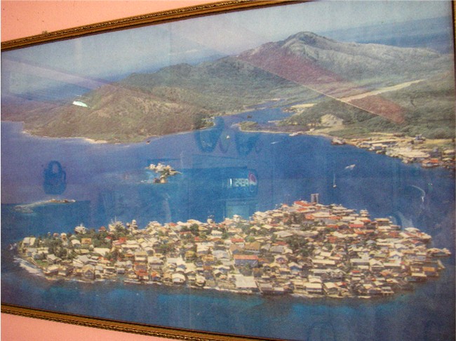
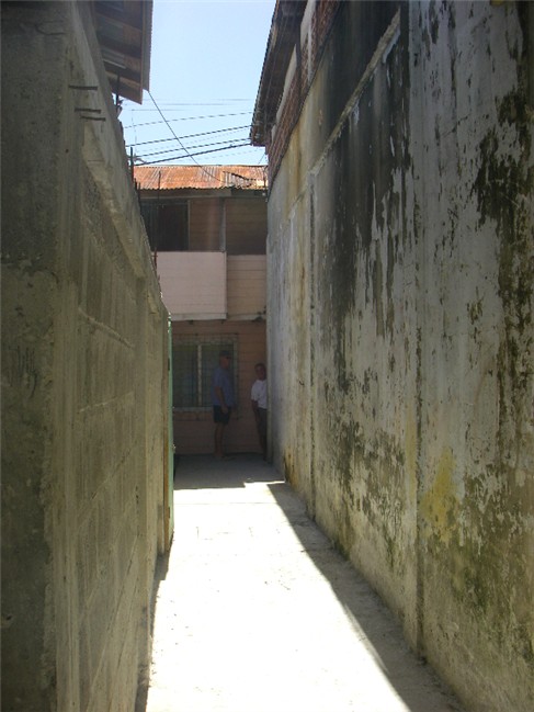
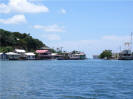
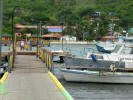
  The
main settlement, Bonacca town (aka "the Settlement"), is a tiny cay
(island) of
less than 100 acres, crammed with 8,000 people. It is accessible
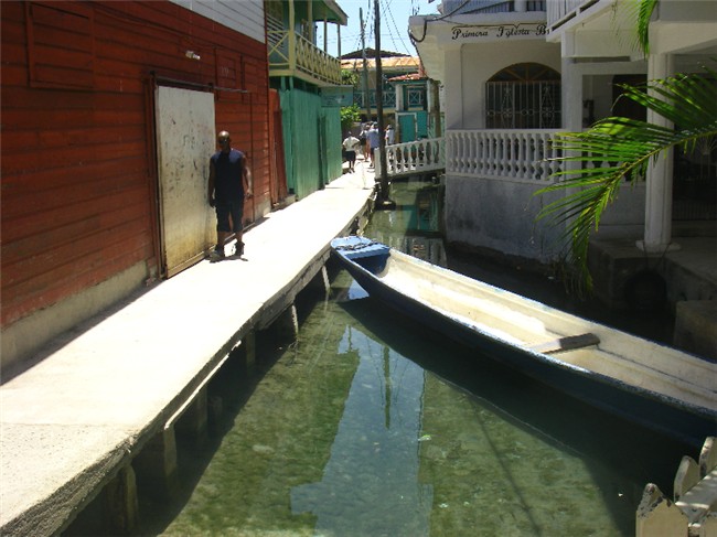
only by boat. The town is a maze
of narrow concrete pedestrian sidewalks and small-boat canals bordered by
2- and 3-story buildings, mostly built on stilts over the water. (Supposedly the stilted architecture was to keep the sand fleas at bay.)
There The
main settlement, Bonacca town (aka "the Settlement"), is a tiny cay
(island) of
less than 100 acres, crammed with 8,000 people. It is accessible
only by boat. The town is a maze
of narrow concrete pedestrian sidewalks and small-boat canals bordered by
2- and 3-story buildings, mostly built on stilts over the water. (Supposedly the stilted architecture was to keep the sand fleas at bay.)
There  are no motorized are no motorized
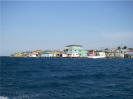 vehicles on this cay. While this is
a funky place, visions of Venice should not come to mind. We dinghy
here to do our grocery shopping (the supply boat comes over from mainland
Honduras every Thursday with fresh produce), buy fuel, use the internet
and mingle with cruisers. By dinghy, it takes us about 20 minutes to
get through the intra-island canal to Bonacca town. vehicles on this cay. While this is
a funky place, visions of Venice should not come to mind. We dinghy
here to do our grocery shopping (the supply boat comes over from mainland
Honduras every Thursday with fresh produce), buy fuel, use the internet
and mingle with cruisers. By dinghy, it takes us about 20 minutes to
get through the intra-island canal to Bonacca town.

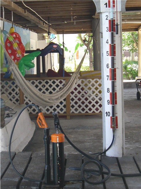
We pull our dinghy right up to this small fuel dock
and easily fill our dinghy fuel tank and spare can. The one pump
handle is for the gasoline. The other pump handle is for the oil
- the calibrated scale on the wall shows how much oil you've
used - the owner supposedly has a patent on this device.
There are 2 much
smaller settlements on the main island of Guanaja - one on the northeast side and one on
the southeast side. Through the center of the island, a wide but shallow
canal cuts through, making access between the north and south
 sides easy - otherwise, a lancha or dinghy would have to go way around the island
outside of the sides easy - otherwise, a lancha or dinghy would have to go way around the island
outside of the
 protection of the reefs. However, until very
recently, the ONLY way around Guanaja was by boat (private or water taxis) or by foot. Now there are a handful of cars and 1 short, but very
nice (why?) concrete, road connecting the 2 settlements. Added very
recently, a "bus" - a small flatbed truck with plank-board seating
and vinyl canopy - now travels this road. Several of us
cruisers took off for a spontaneous hour walk on the beach, and 6 hours
later returned after hiking to these 2 island settlements, used the bus and
checked out the local bars' cold beers (why do they always put on C&W
music when we walk in???) along the way. protection of the reefs. However, until very
recently, the ONLY way around Guanaja was by boat (private or water taxis) or by foot. Now there are a handful of cars and 1 short, but very
nice (why?) concrete, road connecting the 2 settlements. Added very
recently, a "bus" - a small flatbed truck with plank-board seating
and vinyl canopy - now travels this road. Several of us
cruisers took off for a spontaneous hour walk on the beach, and 6 hours
later returned after hiking to these 2 island settlements, used the bus and
checked out the local bars' cold beers (why do they always put on C&W
music when we walk in???) along the way.
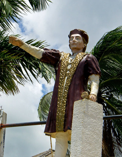
 Christopher
Columbus discovered Guanaja on his fourth voyage to the New World and
named it Pine Island for all the Caribbean pine trees that thickly covered
this hilly island. However, in 1998 Hurricane Mitch was a direct hit
here denuding and destroying most of the pine trees, and rearranging cays and
reefs. Today, we see the green hills dotted with very tall, dead
pine tree poles. The lower vegetation has filled in nicely in many areas,
though. The outer structures of Bonacca town collapsed inward
protecting the central part. Since the days of Columbus, Guanaja has
been known as having the naturally freshest and purist water in most of
the Caribbean. Christopher
Columbus discovered Guanaja on his fourth voyage to the New World and
named it Pine Island for all the Caribbean pine trees that thickly covered
this hilly island. However, in 1998 Hurricane Mitch was a direct hit
here denuding and destroying most of the pine trees, and rearranging cays and
reefs. Today, we see the green hills dotted with very tall, dead
pine tree poles. The lower vegetation has filled in nicely in many areas,
though. The outer structures of Bonacca town collapsed inward
protecting the central part. Since the days of Columbus, Guanaja has
been known as having the naturally freshest and purist water in most of
the Caribbean.
|
|
PASSAGE
SOUTH
from HONDURAS
to PANAMA
May - June, 2008: For some reason, high
winds plagued Guanaja (and only Guanaja!) for 3 weeks straight, keeping us
held up at Michael Rock - which isn't really a bad thing - except as June
creeps closer so do the tropical waves, depressions and eventually
hurricanes. We needed to start south soon. With even higher
winds predicted (over Guanaja) in the days ahead, we decided to make a
perfect day
sail south to mainland Honduras where we could stage for the expected
roughest part of our trip to Panama. The map below shows our route and
stopovers from the Rio Dulce, Guatemala to Panama.
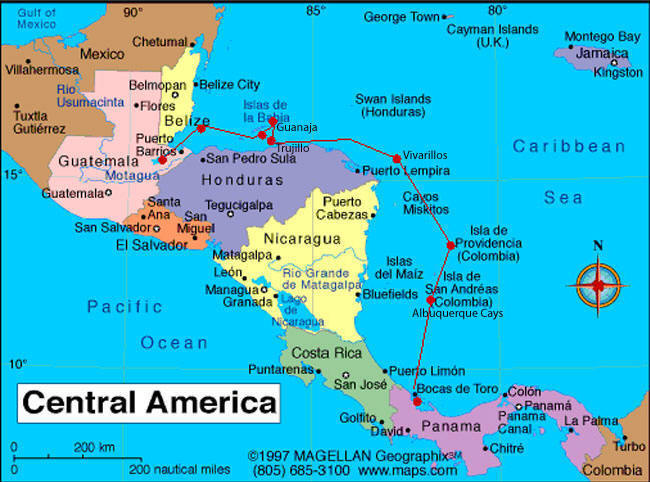
 TRUJILLO
is located on the north central coast of mainland Honduras, and is the last
"civilized" port before heading south. (Stopping on the coast prior to
Panama is NOT a recommended option, as Nicaraguan coastal waters are not safe and Costa
Rica does not have any suitable anchorages.) Trujillo is located at
the end of a huge, deep bay (10 miles x 4 miles) and used to be a nice
vacation destination until a hurricane wiped it out. Today, it's a
nice little town, with bits of historical remembrances of Christopher
Columbus (we're beginning to wonder if there is any place TRUJILLO
is located on the north central coast of mainland Honduras, and is the last
"civilized" port before heading south. (Stopping on the coast prior to
Panama is NOT a recommended option, as Nicaraguan coastal waters are not safe and Costa
Rica does not have any suitable anchorages.) Trujillo is located at
the end of a huge, deep bay (10 miles x 4 miles) and used to be a nice
vacation destination until a hurricane wiped it out. Today, it's a
nice little town, with bits of historical remembrances of Christopher
Columbus (we're beginning to wonder if there is any place
 down here that
Chris did NOT land???), the Spaniards and pirates. Even William
Walker, the American mercenary who eventually proclaimed himself president
of Central America, made it here where he was finally executed in 1860 and
buried - right here in Trujillo. We anchored off Casa
Kiwi, a nice little bungalow, restaurant & bar located near absolutely nothing.
But the New Zealand-born owner is very accommodating and took our group into
Trujillo, as well as hosting good happy hours, while we waited for our next
weather window. down here that
Chris did NOT land???), the Spaniards and pirates. Even William
Walker, the American mercenary who eventually proclaimed himself president
of Central America, made it here where he was finally executed in 1860 and
buried - right here in Trujillo. We anchored off Casa
Kiwi, a nice little bungalow, restaurant & bar located near absolutely nothing.
But the New Zealand-born owner is very accommodating and took our group into
Trujillo, as well as hosting good happy hours, while we waited for our next
weather window.
|
NIGHTTIME
APPROACHES
Most cruisers wisely will not enter an
unknown anchorage in the dark, which includes us. (We adjust boat
speed or lay off until daylight.) But on this trip, we did it TWO
times - Yikes! Having said
that, in both cases, a boat from our group had made it in before dark, so
they were able to guide the other boats in by radio and their boat lights.
 It
can be very surreal and disorienting to approach in the dark, especially
when there is no land visible - you have to rely on your charts (some made
in the 1800's!) and instruments (kind of like flying on instruments only).
Now consider having charts that are not accurate - which is the case for
this area - and then you're really screwed. It
can be very surreal and disorienting to approach in the dark, especially
when there is no land visible - you have to rely on your charts (some made
in the 1800's!) and instruments (kind of like flying on instruments only).
Now consider having charts that are not accurate - which is the case for
this area - and then you're really screwed.
We entered the Vivarillos in pitch
dark - 3/4 of it surrounded by reefs, no civilization or lights, no moon
light (thick cloud cover), and the cays not visible (heck, you can barely
see them in the daylight!).
Although Providencia has channel
markers, they did not correspond to the chart or waypoints that we had (it
appeared we would have ended up on land following it). With
conflicting information, we turned back out to sea, consulted with friends
already in, and found our way in totally ignoring the chart and using only
the channel markers (which was then easy). |
|
"GOIN' 'ROUND THE
CORNER" is the worst
part of heading south to Panama, that is, getting around Honduras' northeast
coast, and at this time of the year usually means bashing head on into east
winds and kicked up seas. So picking a couple of days of lighter winds,
or north winds if you're lucky,
is most desirable. There were five other boats waiting with us and we
all left together for the
approximate 40-hour trip. In hind sight, we should have waited another
day, but we all decided to go for it. A tropical
 wave,
spawned off a tropical
storm, became a lot more than predicted and went right over our heads.
Punching through stout seas with strong winds on the nose made for a very
slow and uncomfortable trip. As such, we had to tack back and forth
while motorsailing (motoring with sails up at an angle to the wind to
lessen the impact). In between white-out rain showers during daylight,
we spotted a water spout (tornado over water) coming up behind us - and not
that far away. It was close enough for us to see the sea water being
sucked up into its vortex.
We immediately took down our sails and started securing things in the
cockpit when it thankfully dissipated. (I kick myself now, but I opted
to assist with taking down the sails first instead of getting my camera and
taking a picture of the water spout - it would have been an awesome picture
- but safety first!) Although we had originally
planned on making a stop at the aquarium-like reef- and coral-strewned
Hobbies, the slow trip (at least 200 nm with all our tacking in 38 hours)
was going to put most of us in after dark, so we changed course to the Vivarillos, a short distance away. Although it is partially surrounded
by reefs, it is a more straightforward approach. See box "Nighttime
Approaches". wave,
spawned off a tropical
storm, became a lot more than predicted and went right over our heads.
Punching through stout seas with strong winds on the nose made for a very
slow and uncomfortable trip. As such, we had to tack back and forth
while motorsailing (motoring with sails up at an angle to the wind to
lessen the impact). In between white-out rain showers during daylight,
we spotted a water spout (tornado over water) coming up behind us - and not
that far away. It was close enough for us to see the sea water being
sucked up into its vortex.
We immediately took down our sails and started securing things in the
cockpit when it thankfully dissipated. (I kick myself now, but I opted
to assist with taking down the sails first instead of getting my camera and
taking a picture of the water spout - it would have been an awesome picture
- but safety first!) Although we had originally
planned on making a stop at the aquarium-like reef- and coral-strewned
Hobbies, the slow trip (at least 200 nm with all our tacking in 38 hours)
was going to put most of us in after dark, so we changed course to the Vivarillos, a short distance away. Although it is partially surrounded
by reefs, it is a more straightforward approach. See box "Nighttime
Approaches".
 VIVARILLOS is
made up of two very small cays (and shallow banks) in the middle of nowhere
off Honduras' southeast
coast. This area is known for diving, snorkeling and spear fishing,
but with overcast, rainy skies, and some kind of boat repairs to be done by
everybody (we only had a couple of very minor things to do), we didn't
venture off the boat to explore. (We also didn't want to have to
launch the dinghy, which we carry on the foredeck for open VIVARILLOS is
made up of two very small cays (and shallow banks) in the middle of nowhere
off Honduras' southeast
coast. This area is known for diving, snorkeling and spear fishing,
but with overcast, rainy skies, and some kind of boat repairs to be done by
everybody (we only had a couple of very minor things to do), we didn't
venture off the boat to explore. (We also didn't want to have to
launch the dinghy, which we carry on the foredeck for open
 passages, with the outboard on the stern rail, for just a
quick jaunt. It takes a little less than an hour to launch and at
least an hour to prepare it for passage making.) After 2 days here,
our next weather window (aimed at being able to sail, instead of
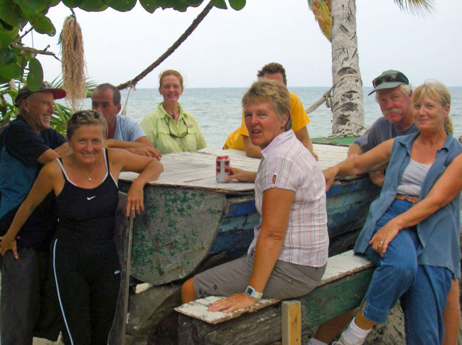
motorsailing) appeared. Six boats had left Trujillo together, one of
which had to turn back due to engine problems. The remaining four (and
sometimes the fifth) stayed together until we reached Panama.
Traveling with a group like this makes it fun, gives you others to discuss
weather and boat issues with, and provides a measure of security. It
was also an international group: Another Texas boat (down here, Texas is
considered a country), Australian/Croatian, Brits and French/French
Canadian. passages, with the outboard on the stern rail, for just a
quick jaunt. It takes a little less than an hour to launch and at
least an hour to prepare it for passage making.) After 2 days here,
our next weather window (aimed at being able to sail, instead of
motorsailing) appeared. Six boats had left Trujillo together, one of
which had to turn back due to engine problems. The remaining four (and
sometimes the fifth) stayed together until we reached Panama.
Traveling with a group like this makes it fun, gives you others to discuss
weather and boat issues with, and provides a measure of security. It
was also an international group: Another Texas boat (down here, Texas is
considered a country), Australian/Croatian, Brits and French/French
Canadian.
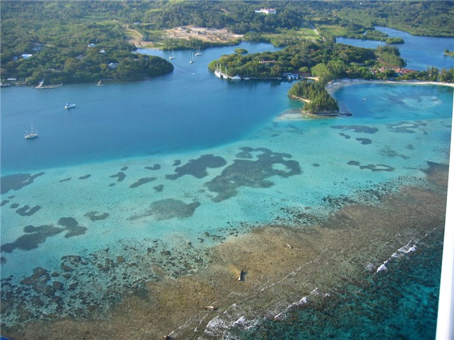
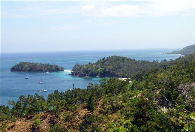
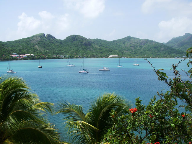
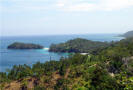
  ISLA PROVIDENCIA,
located 150 miles off the coast of Nicaragua but belonging to Colombia, was our
next stop after covering 210 nm
in 34 hours - it was a good sail - entering the harbor after dark. See
box "Nighttime Approaches". This scenic anchorage is surrounded by two
green, hilly islands connected by a brightly-painted footbridge. Providencia is a very neat (nicely maintained scenic walkways), clean (trash
receptacles widely ISLA PROVIDENCIA,
located 150 miles off the coast of Nicaragua but belonging to Colombia, was our
next stop after covering 210 nm
in 34 hours - it was a good sail - entering the harbor after dark. See
box "Nighttime Approaches". This scenic anchorage is surrounded by two
green, hilly islands connected by a brightly-painted footbridge. Providencia is a very neat (nicely maintained scenic walkways), clean (trash
receptacles widely
  used) and colorful (all over) French-feeling island,
reminiscent of the small French islands of The Saintes, Guadeloupe, in the
eastern Caribbean (minus the fresh baguettes). There
are about 5,000, mostly English-speaking, inhabitants. Life is good here, people extremely friendly and helpful, and absolutely no security
problems. This island will
hopefully retain its charming character, as mainland Colombians and foreigners are not
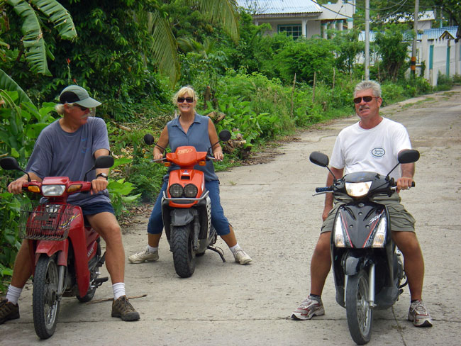
allowed to own land on this island. Our group rented motorscooters
(people drive in a civilized manner here, most using motorscooters) and
explored the island (4 miles x 3 miles), and had several great dinners out. used) and colorful (all over) French-feeling island,
reminiscent of the small French islands of The Saintes, Guadeloupe, in the
eastern Caribbean (minus the fresh baguettes). There
are about 5,000, mostly English-speaking, inhabitants. Life is good here, people extremely friendly and helpful, and absolutely no security
problems. This island will
hopefully retain its charming character, as mainland Colombians and foreigners are not
allowed to own land on this island. Our group rented motorscooters
(people drive in a civilized manner here, most using motorscooters) and
explored the island (4 miles x 3 miles), and had several great dinners out.

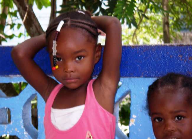
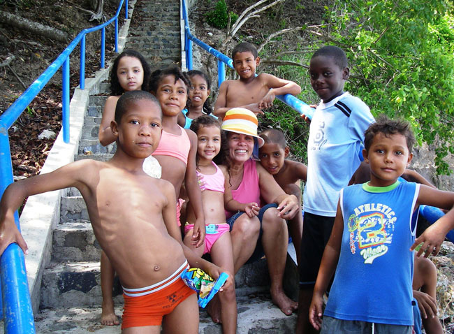
Her mom is a hair dresser |

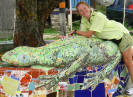 A
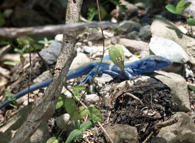
very blue lizard . . . and a very artistic one A
very blue lizard . . . and a very artistic one |

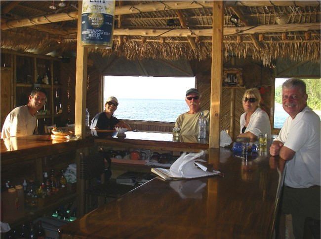
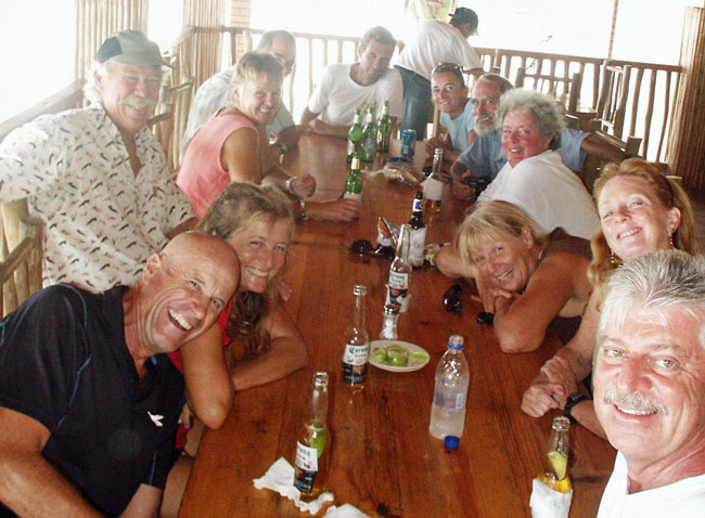
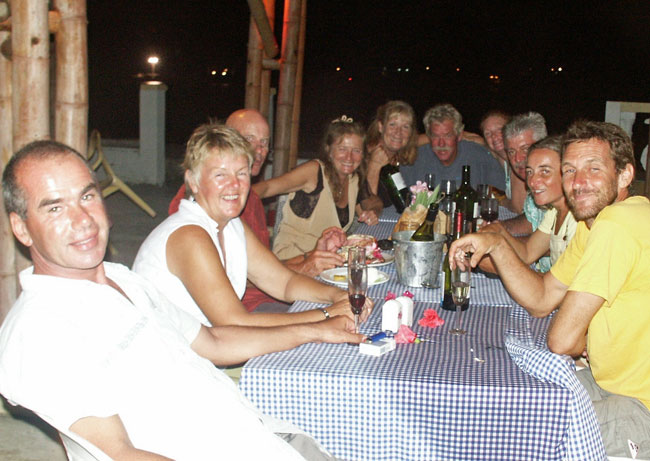
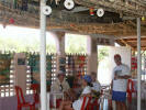
Group dinner at Bamboo |
|

This "Wanted" poster for Colombian
terrorists was in the immigration office; top reward is US$2.7 million |
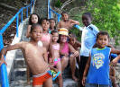
School kids on a field trip of sorts |

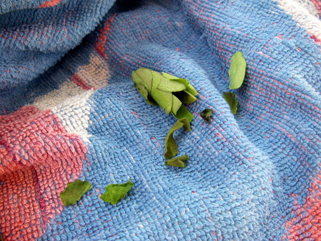
Bees would come to all our boats
with bits of green leaves, and build nests in the winches, towels, etc. |
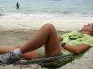
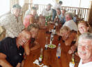
Too many beers for Deb . .
. but Steve manages to focus the camera on . . . |
After a week we decided we should
head on (it's now approaching mid June), although we all would have
loved to stay much longer. We left Providencia at dusk and arrived
mid morning the next day in Albuquerque Cays, 80 nm away, just as the
sun was moving overhead.
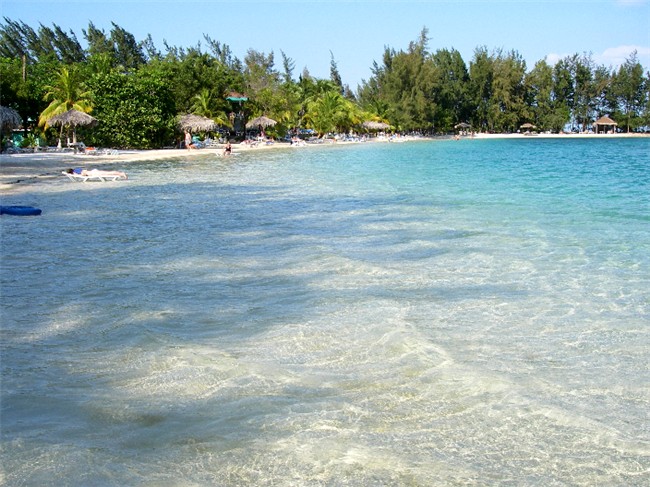
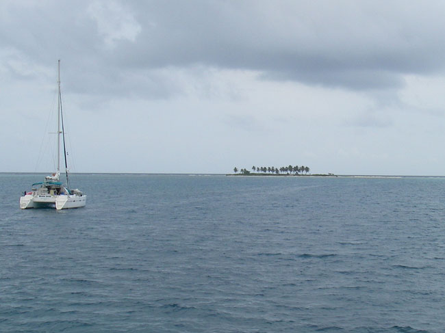
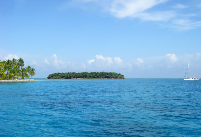
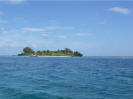
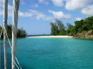
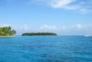 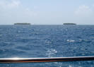 ALBUQUERQUE CAYS
is one of those places that should be a panoramic or aerial shot on a picture postcard.
Out in the middle of nowhere (see above map), there are these two small islands,
both thick with palm trees and surrounded by extensive reefs and coral heads
(that's why we needed the good sunlight overhead to enter) and light
turquoise waters. One island
is a fishing camp and the other island is an outpost for the Colombian ALBUQUERQUE CAYS
is one of those places that should be a panoramic or aerial shot on a picture postcard.
Out in the middle of nowhere (see above map), there are these two small islands,
both thick with palm trees and surrounded by extensive reefs and coral heads
(that's why we needed the good sunlight overhead to enter) and light
turquoise waters. One island
is a fishing camp and the other island is an outpost for the Colombian
  army.
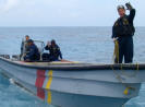
The latter is made up of about
20 young
men who do their 30-day rotation
here. At lunch and in the afternoon, we'd see them playing in the
water or swimming out to our boats to visit. We were also paid a
routine visit by the Colombian Coast Guard
(they actually own a boat - not
always the case in some countries!) who occasionally patrols the
area
(they're based out of Providencia). We've been through
this enough times in other
countries that we know what to army.
The latter is made up of about
20 young
men who do their 30-day rotation
here. At lunch and in the afternoon, we'd see them playing in the
water or swimming out to our boats to visit. We were also paid a
routine visit by the Colombian Coast Guard
(they actually own a boat - not
always the case in some countries!) who occasionally patrols the
area
(they're based out of Providencia). We've been through
this enough times in other
countries that we know what to
 expect. Here,
we are
boarded by a couple of the expect. Here,
we are
boarded by a couple of the
 cute young men,
who are very nice and polite and
speak English, who want
to see if everything is OK and check our papers.
After some small talk, they head out to the
next boat. We four boats
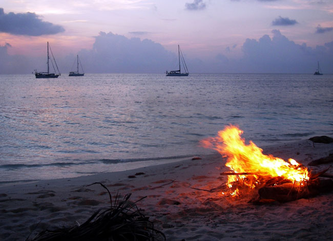
(the French stayed behind in Providencia) are the only boats here. One
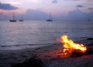
evening we have a beach bonfire and dinner with fish that some of the guys
speared that day. cute young men,
who are very nice and polite and
speak English, who want
to see if everything is OK and check our papers.
After some small talk, they head out to the
next boat. We four boats
(the French stayed behind in Providencia) are the only boats here. One
evening we have a beach bonfire and dinner with fish that some of the guys
speared that day.
 |
 |
 |
 |
 |
|
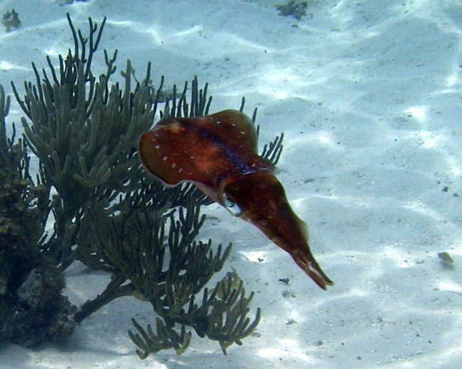
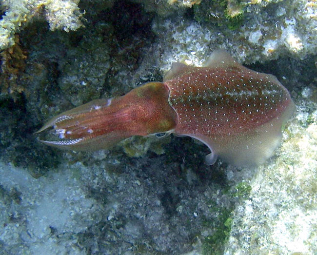
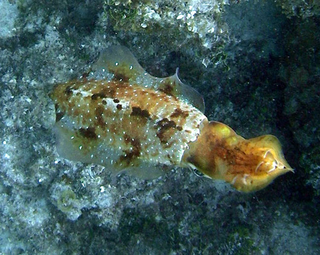
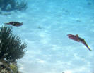
Squid: They change colors
(camouflage) in seconds |
| |
|
|
|
|
 |
 |
 |
 |
 |
|
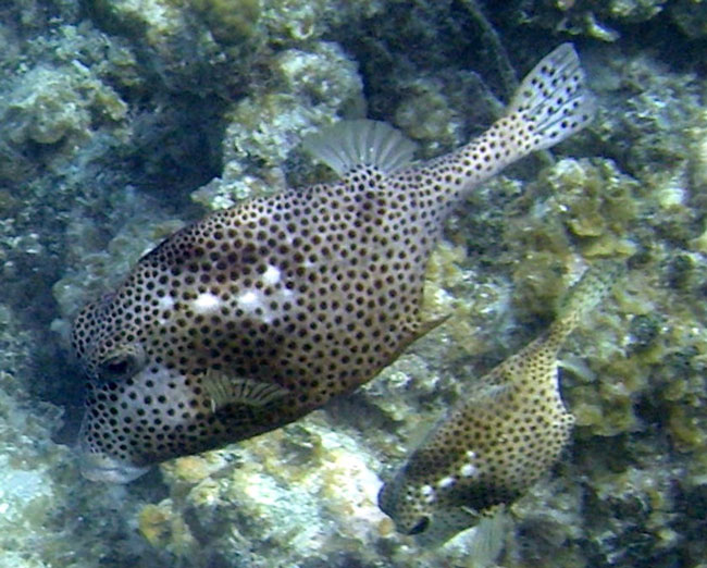
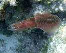
Spotted Trunkfish(s) |
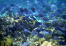
Hundreds of Blue Tang and Doctorfish |
|
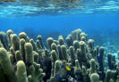
Unusual coral; Queen Angelfish at
bottom |
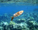
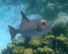
Large Ocean Triggerfish |
We all wanted to
spend more time here, but once again, the weather forecast told us that the
time had come to move on. The Australians, sounding in their dinghy,
had found a shortcut through the reefs that we all used the next day - but
we waited until mid morning to leave when the sun was high enough and the
underwater features were clearly visible. It was a pleasant overnight
sail with perfect winds until
they died the next day close to Panama (which is typical), and after 30
hours we arrived at Bocas del Toro, Panama
. . .
|
|
Continue to
Panama . . . |
[ Back ] [ Home ] [ Up ] [ Next ] [
Top of page ]
|